WINTER 2012_KINGDOM COME: 2012 – 13.0.0.0.0
_CENTRAL AMERICA
Projects
- Aditnálta: An Island Dispersed Across the Internet by Mond Qu
- OFF GRID: Laser Telecommunications Infrastructure by Will Gowland
- System D Logistics by Zhan Wang
- Earth 3263 by Gustav Toftgard


“Over the Mountains of the Moon, down the Valley of the Shadow, ride, boldly ride…if you seek for El Dorado." Edgar Alan Poe
The Unknown Fields Division is a nomadic design studio that ventures out on biannual expeditions to the ends of the earth exploring unreal and forgotten landscapes, alien terrains, and obsolete ecologies. Far from the metropolis lie the dislocated hinterlands that support the mechanizations of urban life. A city like London is thoroughly embedded in a global network of landscapes and infrastructures that are typically forgotten, unseen, ignored or only presented through particular media narratives. Each year we navigate a different global cross section and seek to map the complex and contradictory realities of the present as a site of strange and extraordinary futures. For Unknown Fields the journey is really about seeing our familiar world differently; we explore these alternative worlds as a means to understand our own in new ways, either through physical expeditions or the design of speculative future projects.
This year as the world of new agers, mystics and psychonauts pilgrimage south, Unknown Fields journeys with them to Central America to ponder the rise and fall of cities, civilizations, and empires, both ancient and modern, and to investigate the cultural and technological infrastructures that underpin them – a network of complex systems that have proved critical to their prosperity and ultimately often implicated in their collapse.
Empires rise and fall and the infrastructural traces they leave behind are evidence of their greatest dreams and their deepest fears. They are the remains of a speculative future, the skeletal frames of world building dreams, the ruled lines on a page soon to be filled with the goings on of a day soon to come. In this time of crisis the future is becoming a project again. As the Mayan long count calendar begins a new phase we will imagine what comes next.
<
12/13 Division Roster
Leaders: Liam Young and Kate Davies
Troops: Artemis Doupa, William Gowland, Selim Halulu, Tobias Jewson, Chapman Kan, Harry Kay, Stefan Laxness, Ling Leng, Mond Qu, Evan Saarinen, Jack Self, Gustav Toftgard, Christina Varvia, Zhan Wang
![]()
Aditnálta: An Island Dispersed Across the Internet by Mond Qu
Unknown Fields Department of Ghost Geographies_Winter 2012_Central America 16°20'53.2"N 94°49'30.3"W
The UN have recently reported financial links between Mexico’s Los Zeta cartel and the illegal trading of the rare earth mineral Otinif, a material critical to the manufacture of the next generation of super faster digital processors. Seen from Google earth Aditnálta is an anonymous island off the East Coast of Mexico but as the world’s richest source of Otinif it is a landscape being consumed by our hunger for technology. Hidden from this distanced aerial view are vast underground worker towns and oppressive mining conditions. Aditnálta is an outsourced landscape embedded in all the pieces of technology we carry in our pockets.
Aditnálta is also entirely fictional. In our Department of Ghost Geographies Mond Qu has constructed and dispersed the forged fragments of this island across the internet. This imaginary place is made manifest through hoax listing on Wikipedia and Google maps, live webcams of scale model stage sets, faked articles on news sites and green screen CGI composites on Flickr, Youtube and Panoramio. Just like the real landscapes of outsourced electronics production we consume Aditnálta at a distance, through edited media narratives, disconnected from the realties that go on there. Through the construction of elaborate fictions we can reveal important truths
ADITNALTA SITE MAP
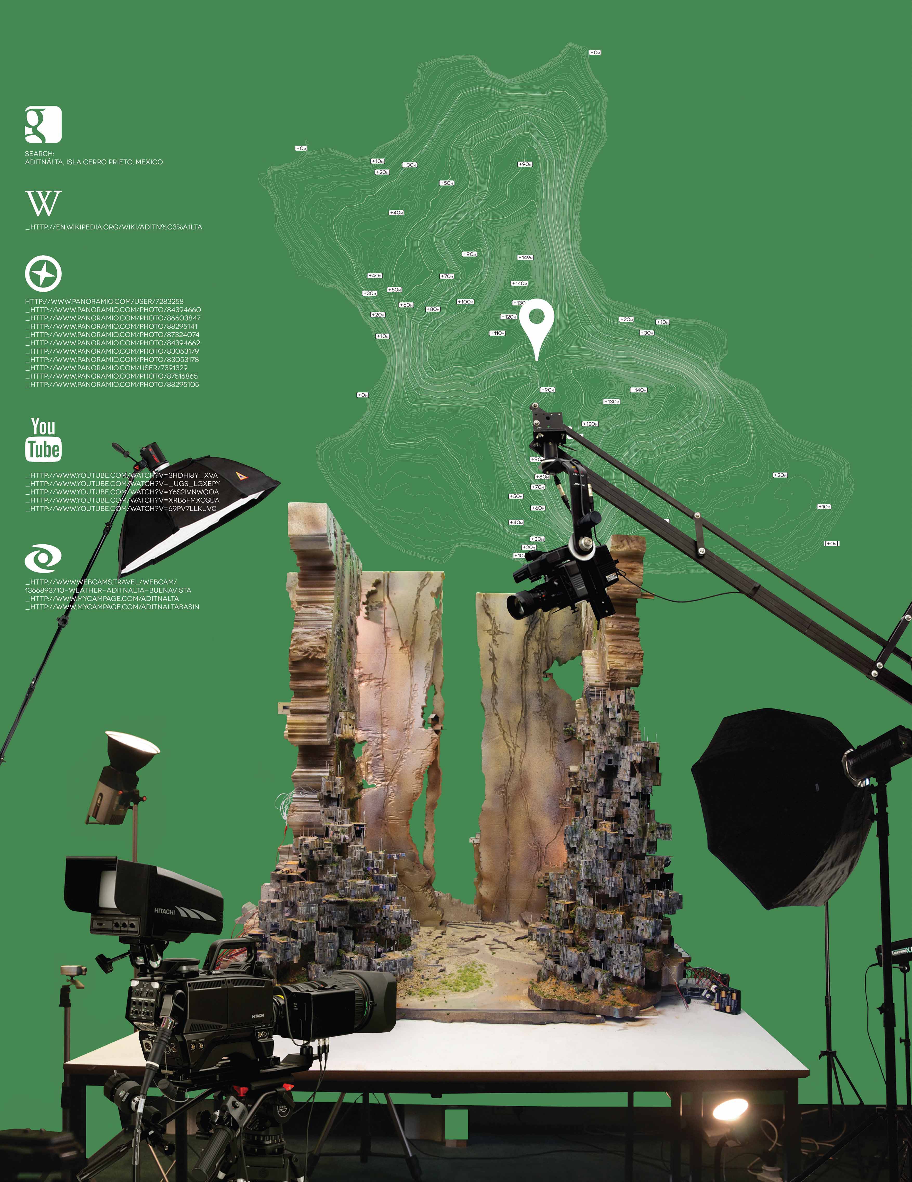
A MODEL DESIGNED FOR THE INTERNET
A miniature model stage set designed for eye of live webcams, it co-ops the techniques used in the special effects industry. The form of the city references the growth patterns of informal settlements on the periphery of Mexico city. Drawing on the materiality and detail of the model references the ad-hoc construction of other illegal mining communities around the world. The model is constructed as a false perspective, the front of the model is 1:100 and the recedes in the distance as 1:200.
![]()
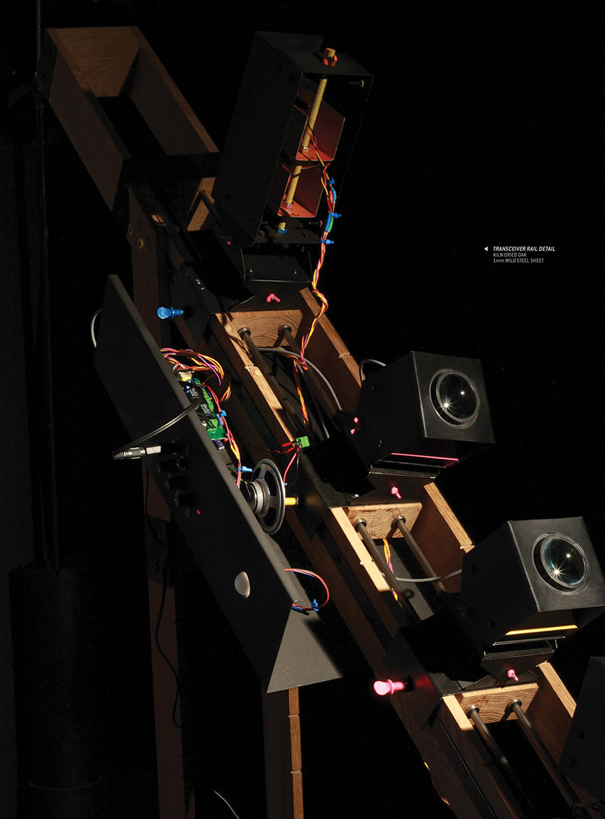
OFF GRID: Laser Telecommunications Infrastructure by Will Gowland
Unknown Fields Tactical Technologies Division_Winter 2012_Central America 19°26'06.3"N 99°08'19.7"W
Holding a 90% monopoly on telecommunications in Mexico, Carlos Slim is the world’s richest man. With little resilience and at the mercy of corporate greed, we put our faith in these aging centralised systems that are now beginning to show their cracks. William Gowland of our Tactical technologies Division has built the components for a network infrastructure that undermines and subverts this monopoly. Borrowing from the cartels radio communication network, a laser line of sight communication system is created that is not elicit or illegal, but off grid and under the radar. The result is a decentralised communication system that is local, ad hoc and resilient. A performative urban landscape emerges that facilitates the neighbourhood relationships, communities and markets that are lost in a city of global telecommunications. The system is open source and mobile, and the communities of the city soon develop their own constellation of transceivers and mirror relays, cultures, practices and procedures. The telecommunications monopoly is evolving into a DIY city of calibration graffiti, carved and sculpted building surfaces, reflectivity, absorbance and deregulated laser light conversations.
Off Grid system in the context
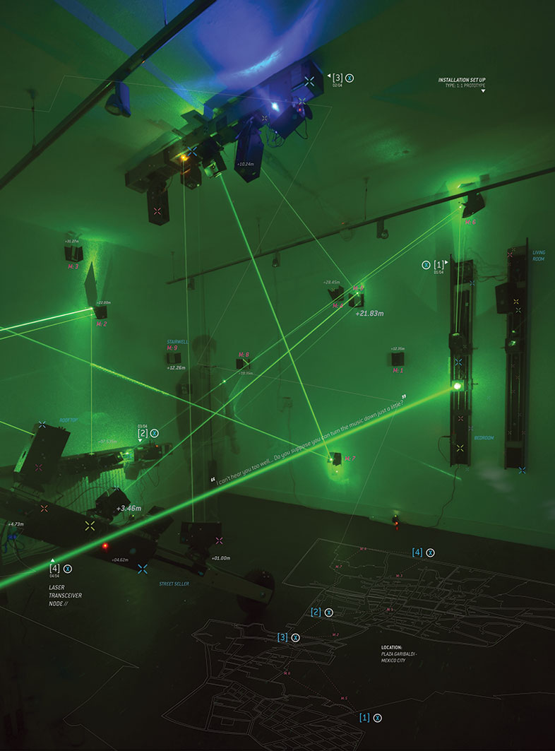
Interactive Installation Setup
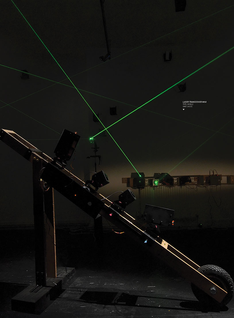
Mobile Transceiver Node
Laser Receiver Close Up
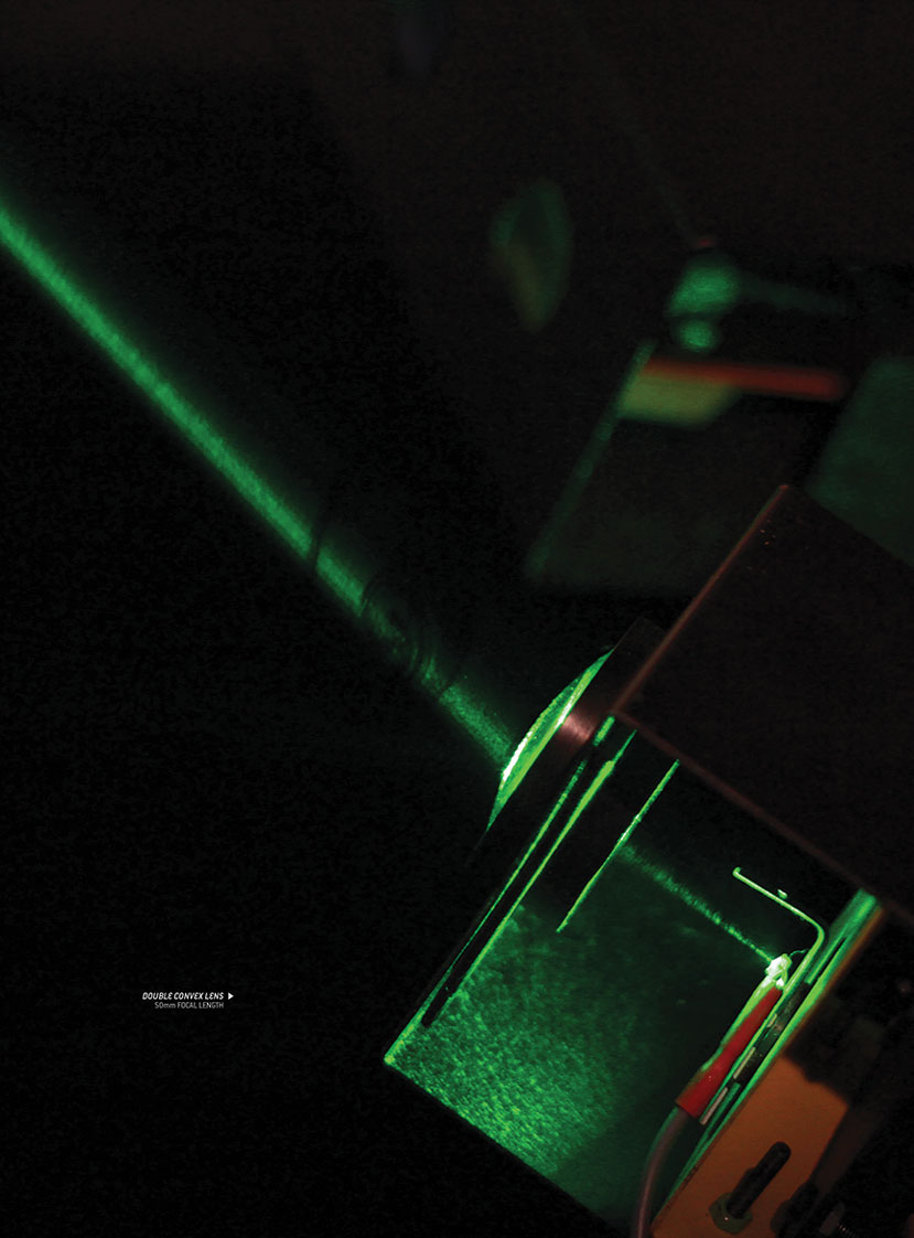
Receiver Lens Detail
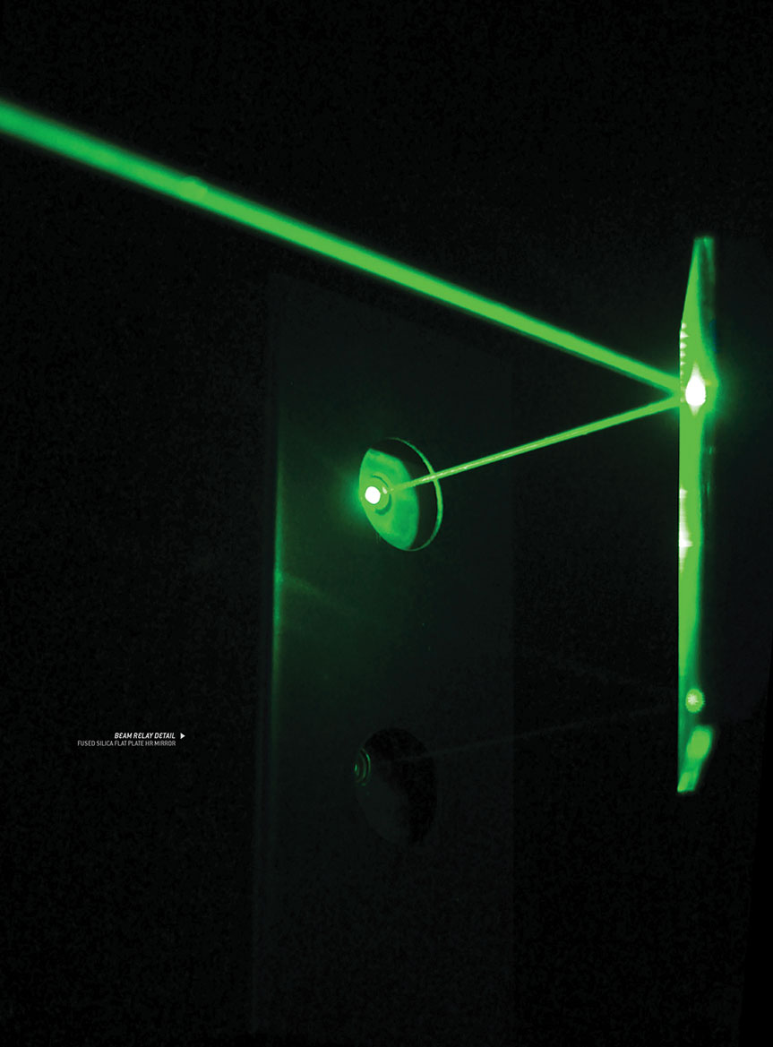
Laser Route 1 Relay
![]()
System D Logistics by Zhan Wang
Unknown Fields Tactical Technologies Division_Winter 2012_Central America 19°12'43.0"N 96°07'24.1"W
As an artery of international trade and a crucial part of the global economy, sea born trade routes are heavily monitored by various technologies that enforce regulations and detect irregular activities. The types of economic activities in question are often described as "under the table" and "off the books" as they are not taxed or included in any Gross National Product. Collectively, this type of trade is the world’s second largest economy, worth $10 trillion a year and employs over half of the world’s population. Zhan Wang of our Tactical Technologies Division has made an inventory of the illicit items that are contained within 1 pixel of google earth’s view of Mexico City and has developed a covert supply chain to smuggle them to the US coastline. Deploying various tactics along the shipping route to evade detection, the logistics operation reveals the extraordinary lengths the authorities go to in order to tax an industry that employs the majority of the population. The technology of surveillance is not infallible, it is full of gaps, cracks and loopholes and is a infrastructural manifestation of the interests of those who profit from the regulation of goods.
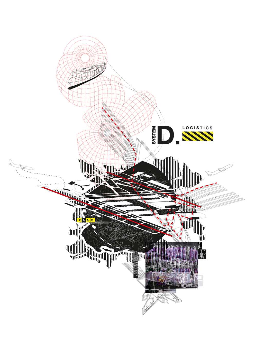
SYSTEM D LOGISTICS- International trade which represents a significant share of the global economy has increased four fold in the past few decades, with sea born trade being the artery of international trade and crucial for the global economy.
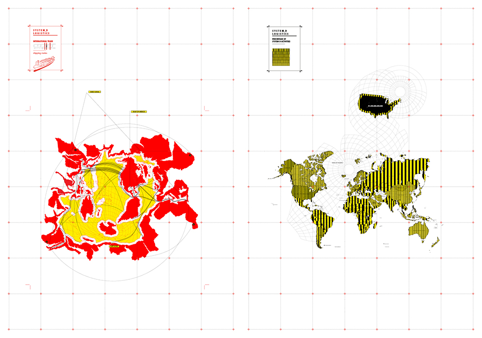
INTERNATIONAL TRADE AND INFORMAL ECONOMY- This increase in international trade is not only contributed to by the advancement of shipping technology, for example containerization and bigger ships, but also by monitoring technologies that safe guard the shipping routes and detect irregular activities. The types of activities in question are often described as under the table and off the books as they are not taxed, monitored by any form of government, or included in any gross national product.

CARGO TRADE DETECTION TECHNOLOGIES
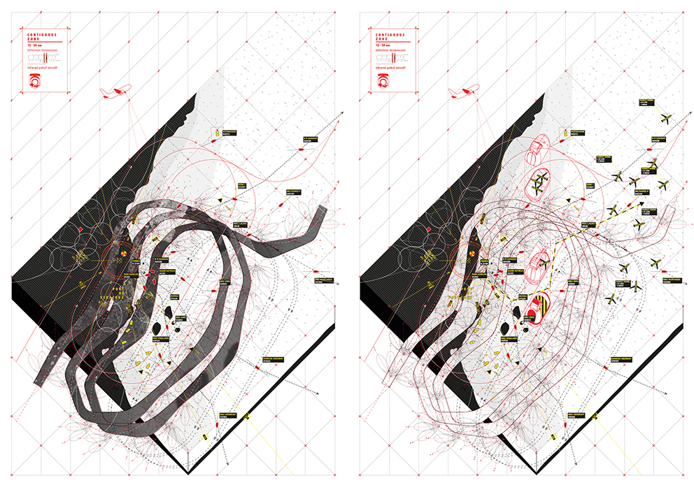
CONTIGUOUS ZONE 12-24 NM
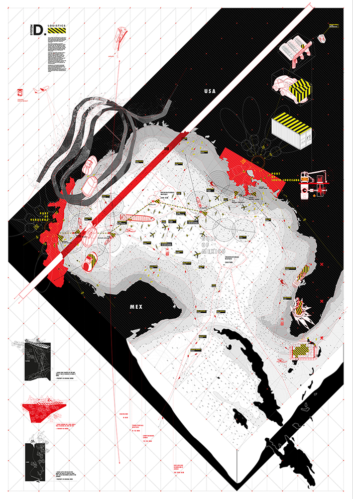
SYSTEM D OVERALL SMUGGLING ROUTE
![]()
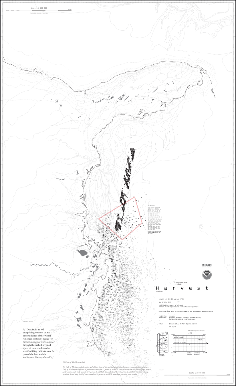
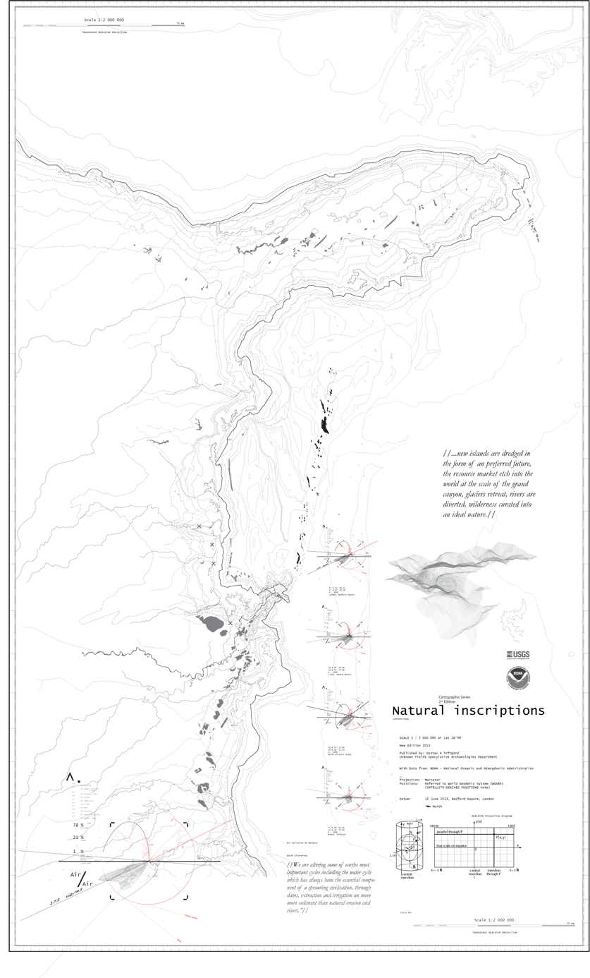
Earth 3263 by Gustav Toftgard
Unknown Fields Speculative Archaeologies Department _Winter 2012_Central America 29°04'02.2"N 85°35'28.6"W
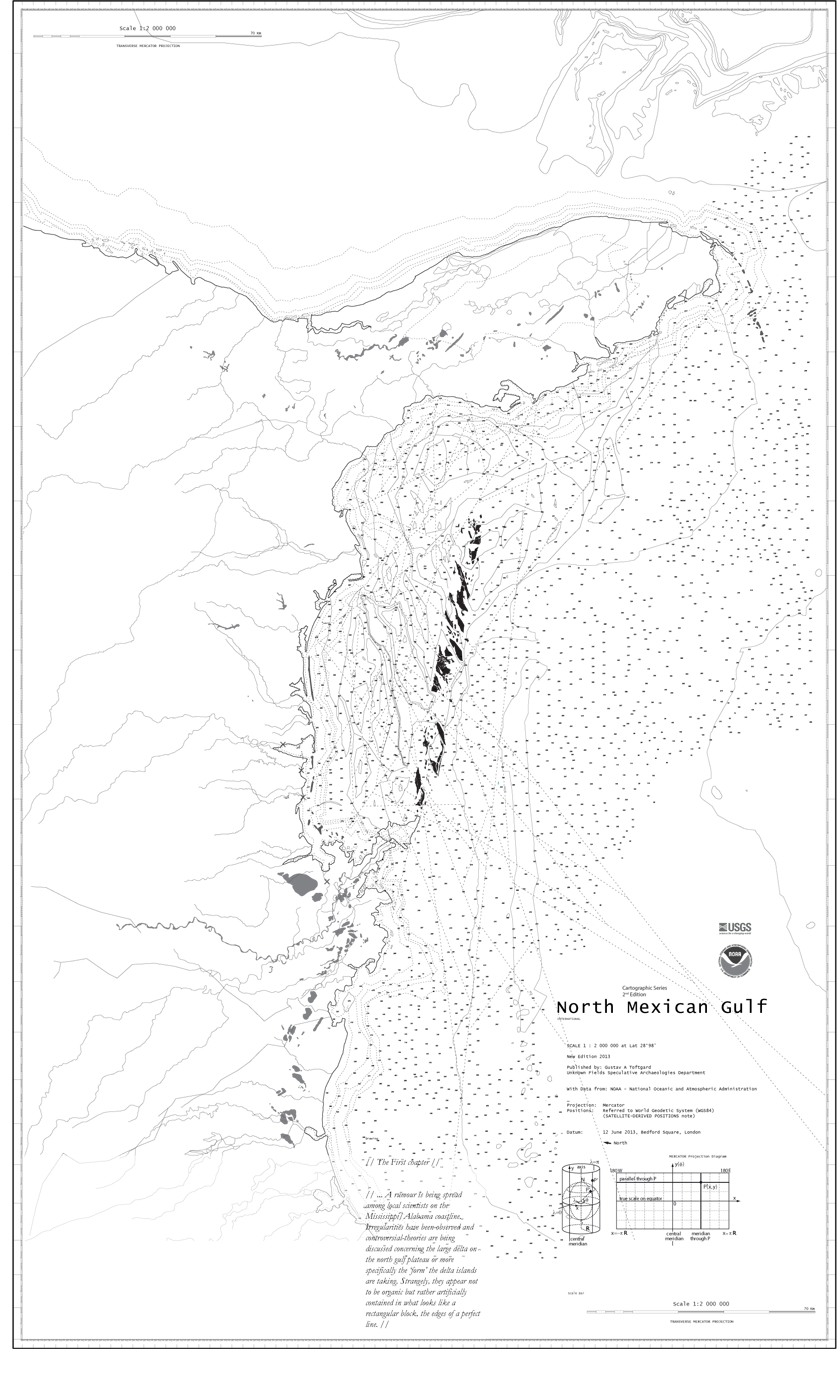
Late spring in the year 2013, a rumour is being spread among local scientists on the Mississippi/Alabama coastline. Irregularities have been observed and controversial theories are being discussed concerning the large delta on the north gulf plateau or more specifically the ‘form’ the delta islands are taking. Strangely, they appear not to be organic but rather artificially contained in what looks like a rectangular block, the edges of a perfect line, almost as if they were constructed.
Studies by Gustav Toftgard in our Speculative Archaeologies Department reveal clues to their creation over time, drawing a timeline dating back to early Mayan civilisations. Satellite photographs, Bathymetric scans of the seafloor as well as core samples taken by oil prospectors reveal traces of hard obstacles systematically dispersed within sediment layers.
Some say this landform is being formed through the deliberate and choreographed manipulations of universal, terrestrial and non-terrestrial systems and through the modification of physical, biological and chemical processes. It is a line being inscribed in the surface of earth as a measurement and ultimate proof of human dominance over nature. It marks what would, in geologic time, be the start of ‘The Anthropocene’ - the age of man.
HARVEST
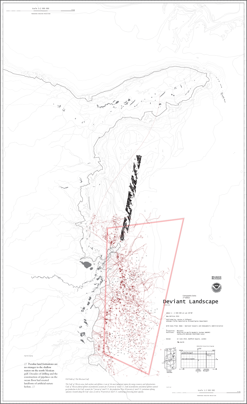
DEVIANT LANDSCAPE
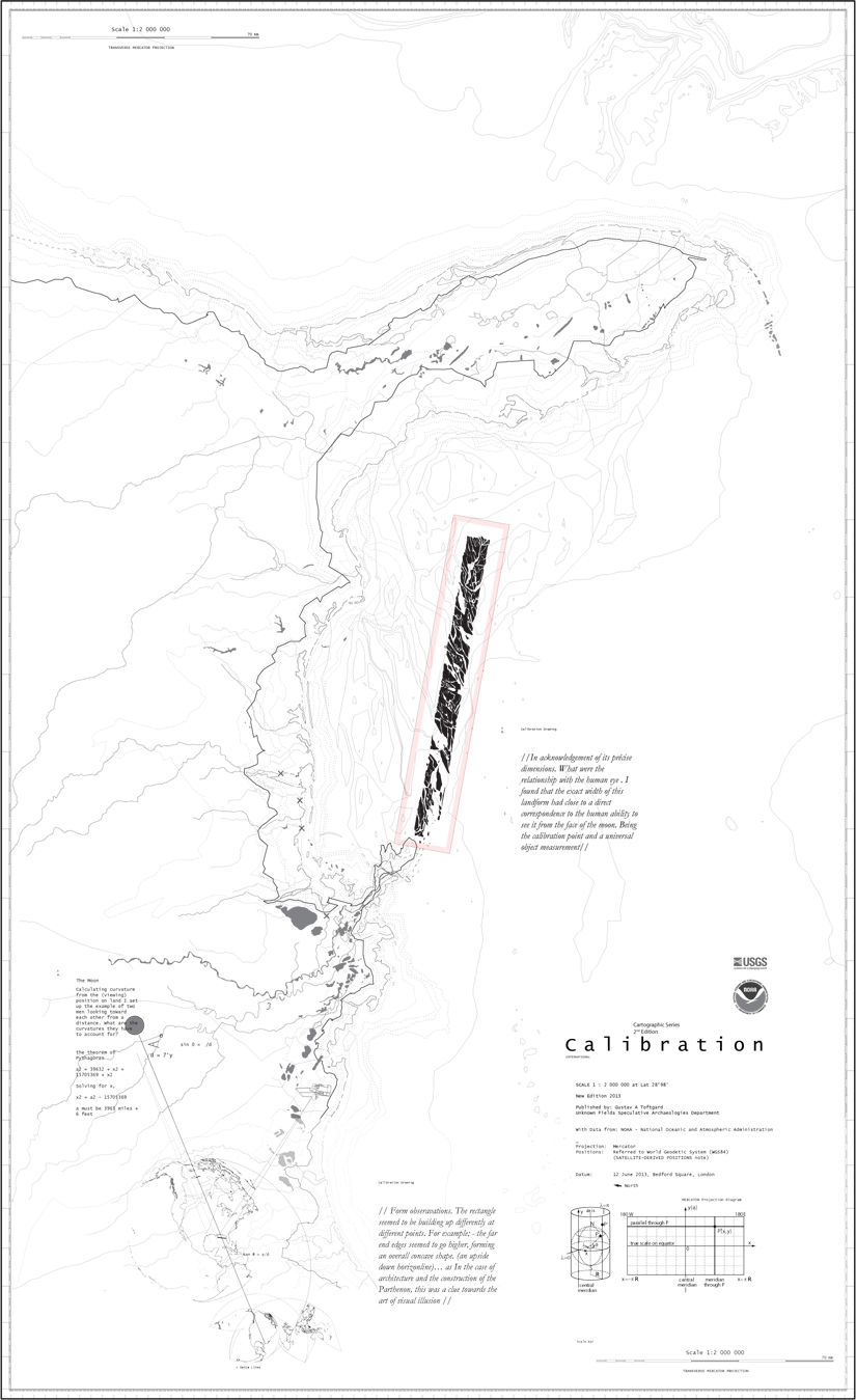
CALIBRATION
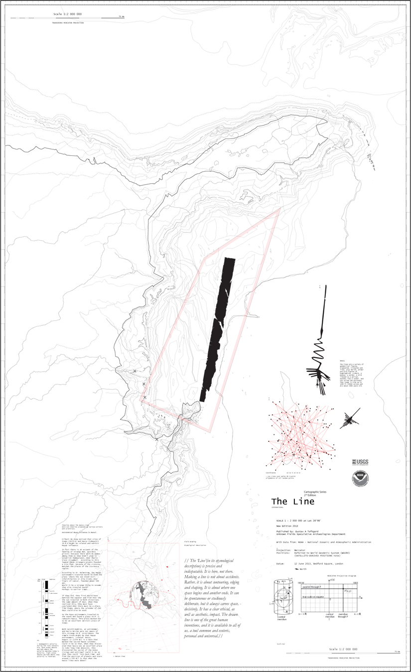
THE LINE
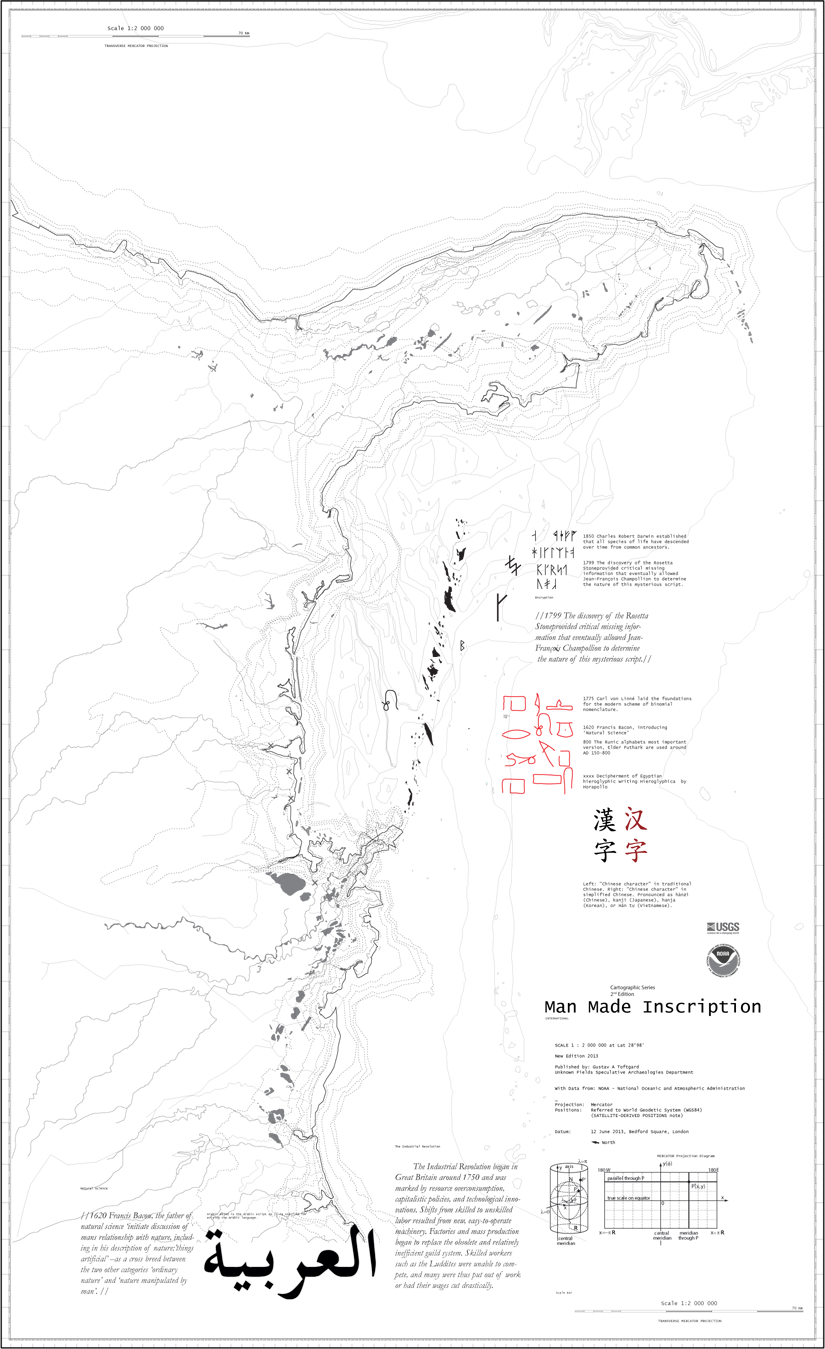
MAN MADE INSCRIPTION
NATURAL INSCRIPTION
THE LINE
MAN MADE INSCRIPTION
THE LINE
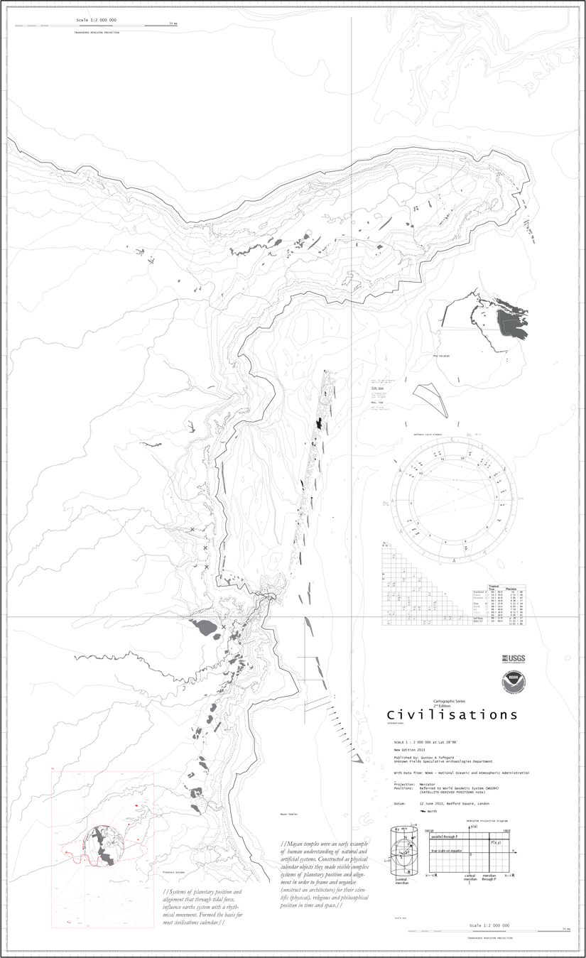
CIVILISATION- YUCATAN
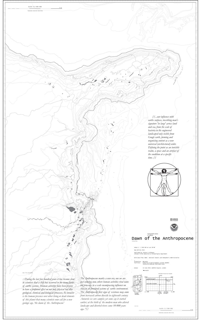
DAWN OF THE ANTHROPOCENE
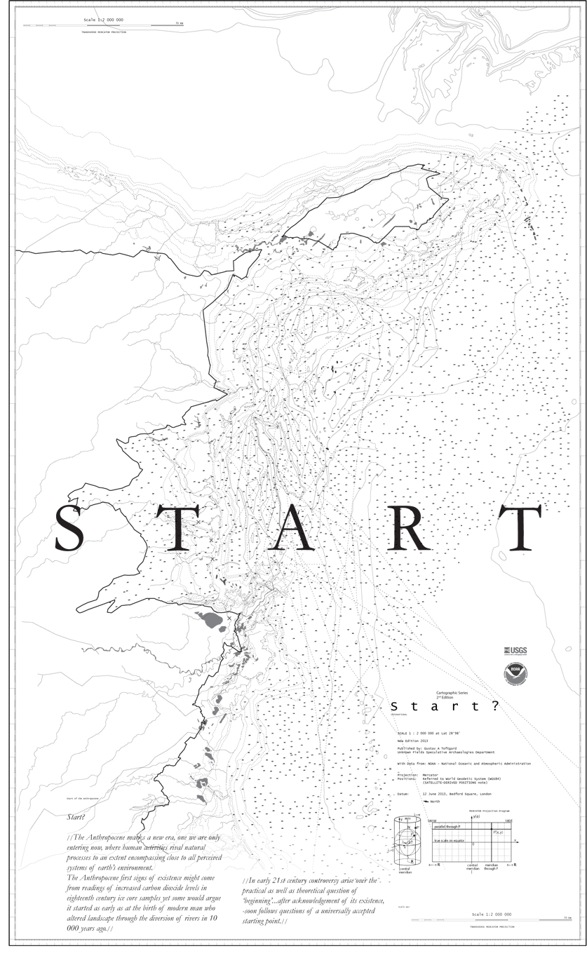
START
![]()